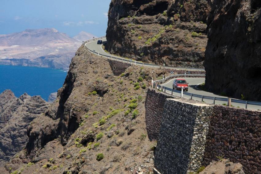
GC 200 starts at the end of the GC 1 motorway at Puerto de Mogán. At first it meanders up the Mogán Valley before heading northwest towards La Aldea town on the west coast. Before you get there you pass they great multicoloured cliff close to Veneguera and drive through the steep Degollada de Tasarte.
Alex Says: Degollada in Canarian is the word used for a steep-sided pass between Barrancos. Its Spanish meaning is a "throat slash".
From the road take the track to Veneguera beach or park up at Tasarte and hike down to Gui Gui beach.
At La Aldea, the road rejoins civilisation before climbing again to the Anden Verde cliffs. Stop at the viewpoint, called el Balcón de Atlantico, for incredible views south to the Dragon's Tail cliffs and north along the rugged cliffs. Say hello to the ravens and ignore the snack man if he's rude (he's horrible to almost everyone who doesn't buy his overpriced snacks).
Just after the viewpoint the road reaches it's highest point and the vertical drop is hundreds of metres. The road here is protected by overhanging nets as it gets hit by rockfalls every time there is rain. Don't drive this section if it is raining or has recently rained: It's dangerous.
La Aldea - Agaete, the GC200. It's a little bit curvy, but mán...La Aldea - Agaete, the GC200. It's a little bit curvy, but man what a road! According to some, it's the most stunning road in Europe. Here's a timelapse of it.
Posted by Gran Canaria on Tuesday, 25 August 2015
The winding drive from the viewpoint to Agaete takes an hour (the locals say it has a bend for every day of the year, but we've never counted them) and the only place for a drink is at El Risco village. Go to the right-hand bar as it's a charming, ramshackle spot that doubles up as the shop. Enjoy the sweets.
At El Risco, walk inland through the village and up the valley to the Charco Azul natural pool with a waterfall. Otherwise head on to Agaete for coffee at the sunken garden or down to the coast at Puerto de las Nieves for seafood.


