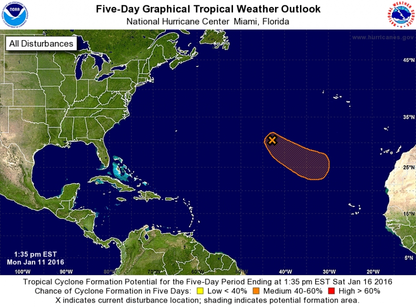
There is currently a non-tropical low-pressure system located over the central Atlantic Ocean about 900 miles southwest of the Azores. It is producing a large area of gale-force winds with maximum winds near 60 mph.
The US National Hurricane Centre currently gives it a 40-60% chance of turning into a tropical storm.
However, all the models suggest that the high-pressure anticyclone currently sitting over North Africa will push it north of the Canary Islands towards the Azores.
The main effect in the Canary Islands will be hot, tropical conditions and attractive high cloud; Great sunsets, sultry nights, and the odd local storm, but no hurricane.
The system will be as close to the Canary Islands as it gets on Wednesday & Thursday of this week.
If it changes direction and heads towards the Canary islands we'll let you know, then find a cellar and look after the wine until it's passed.
Alex Says: Visit our Weather Centre for everything you need to know about the weather in Gran Canaria


